
Sunday Morning Tropical Update
National Weather Service Mobile • June 7, 2020
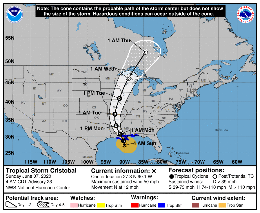
At 4 am TS Cristobal is just offshore of Louisiana
(OBA®) -- Sunday Morning Update on Tropiclal Storm Cristobal.
Here in Orange Beach we have seen 0.3 inches of rain since midnight. OBA Weather Page
From the National Weather Service in Mobile...
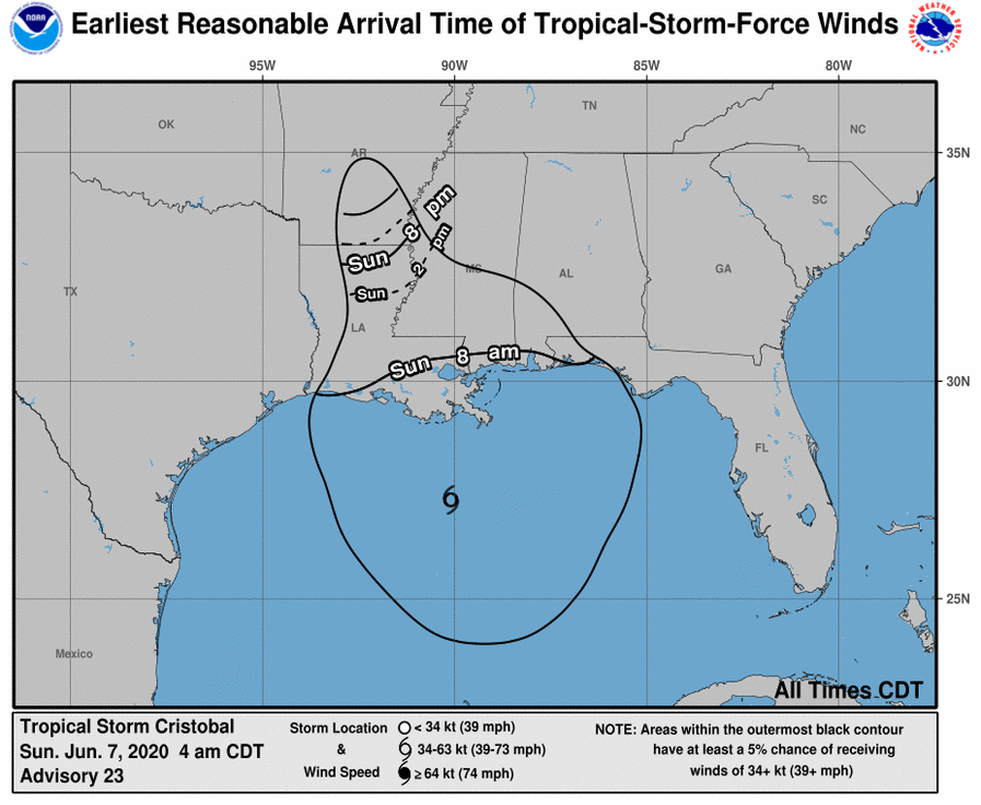
🌀4am #Cristobal Update [06/07]: Cristobal is still forecast to make landfall in southeast Louisiana this evening. A Tropical Storm WARNING remains in effect for Stone and George Counties in southeast Mississippi, extreme southwest Alabama, and the northwest Florida coast. Conditions will continue to deteriorate along the coast this morning with the strongest winds this afternoon.
⚠️ KEY CHANGES: The Flash Flood Watch now includes Choctaw and Clarke Counties in Alabama. The flooding rain threat continues to increase across parts of southeast Mississippi. Coastal Flood Advisory and High Surf Warning run through Tuesday.
⚠️ IMPACTS: Here's what we know...
☔RAIN/INLAND FLOODING: The flooding rain threat continues to increase across parts of southeast Mississippi. Potential for MAJOR to EXTREME flooding across southeast Mississippi. Heavy rain and flooding are likely through Monday morning, especially southeast Mississippi where 4-8" of rain is forecast (isolated totals up to 10 inches possible). Further east, we could see 4-6" in coastal Alabama and 2-3" of rain across northwest Florida. FLASH FLOOD WATCH was expanded further into southwest Alabama. The WATCH continues tor all of southeast Mississippi, parts of southwest Alabama, and northwest Florida.
🌊BEACHES: HIGH risk of rip currents will persist through early next week. High Surf Warning for dangerous 9-12 foot breakers extended through Monday night.
🌊COASTAL FLOODING: 3 feet inundation in northern Mobile Bay, 2-3 feet inundation across coastal Alabama, and 1-3 feet inundation across northwest Florida today and Monday at the time of high tide (10am-2pm). The highest inundation will occur across coastal Alabama on Monday morning. We could see coastal flood issues linger into Tuesday morning. Some of the locations of greatest risk are the west end of Dauphin Island, Causeway over Mobile Bay, immediate shores of rivers that feed into Mobile Bay, low-lying coastal roads in Bayou La Batre and Coden, and the Ft Pickens area. There will be some flooding likely on the Causeway today with more significant flooding on Monday.
🌬️WIND: No major changes. Strongest winds are expected this afternoon. Tropical storm-force winds will most likely arrive early this morning along the coast and late this morning across southeast Mississippi. Winds start to diminish late tonight, but gusty southerly winds will continue along the coast.
🌪️TORNADO: No major changes. Conditions are becoming increasingly favorable for a few tornadoes mainly this afternoon and tonight. The greatest potential for a few tornadoes remains across southeast Mississippi, extreme southwest Alabama, and northwest Florida. Make sure you have a plan and have multiple ways to receive warnings, especially with the possibility of tornadoes while you sleep.
💻LOCAL TROPICAL INFO: www.weather.gov/srh/tropical?office=mob (bookmark it!)
---------------
👉IN-DEPTH DISCUSSION:
The convection near the center of Cristobal remains limited, although it has become a little better organized during the past several hours. In addition, aircraft and scatterometer data show that the radius of maximum winds remains at or above 90 n mi.
The initial motion is north at 10 kt between a deep-layer ridge to Cristobal's east and a mid- to upper-level trough over the western Gulf of Mexico. This general motion should continue for 12-18 hours, followed by a turn toward the north-northwest due to a mid-latitude ridge passing north of the cyclone. After 36 hours, a turn toward the north and north-northeast is expected as Cristobal or its remnants encounter the mid-latitude westerlies. There are no important changes to either the track guidance or the forecast track since the last advisory.
The broad nature of the cyclone and significant dry air entrainment is likely to prevent intensification before landfall, and the new intensity forecast holds the intensity constant at 45 kt until that time. Cristobal remains a broad and asymmetric storm. Therefore, one should not focus on the exact forecast track, as the associated winds, storm surge, and rainfall will extend well away the center.
Share this article w/ Friends...
Gulf Shores, Ala. – (OBA) – Conservation efforts on Alabama’s Gulf Coast have taken another major step forward with the protection of additional land on the Fort Morgan Peninsula. Thanks to a donation from the Alabama Coastal Heritage Trust, the Alabama Department of Conservation and Natural Resources (ADCNR) will permanently preserve 13 ecologically sensitive lots, safeguarding critical habitats from future development.
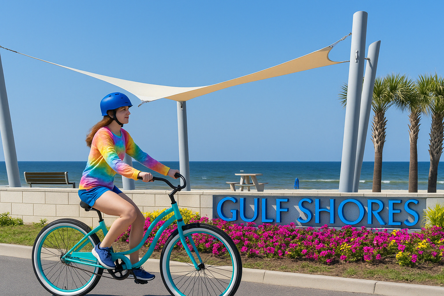
Gulf Shores, Ala. – (OBA) – The City of Gulf Shores has been awarded the Silver-Level Bicycle Friendly Community designation by the League of American Bicyclists. This honor places Gulf Shores among a select group of U.S. cities committed to cycling.
The award highlights Gulf Shores’ efforts to create a safer, more connected place for cyclists of all ages and abilities. It also recognizes the city's major investments in bike trails and active transportation infrastructure.
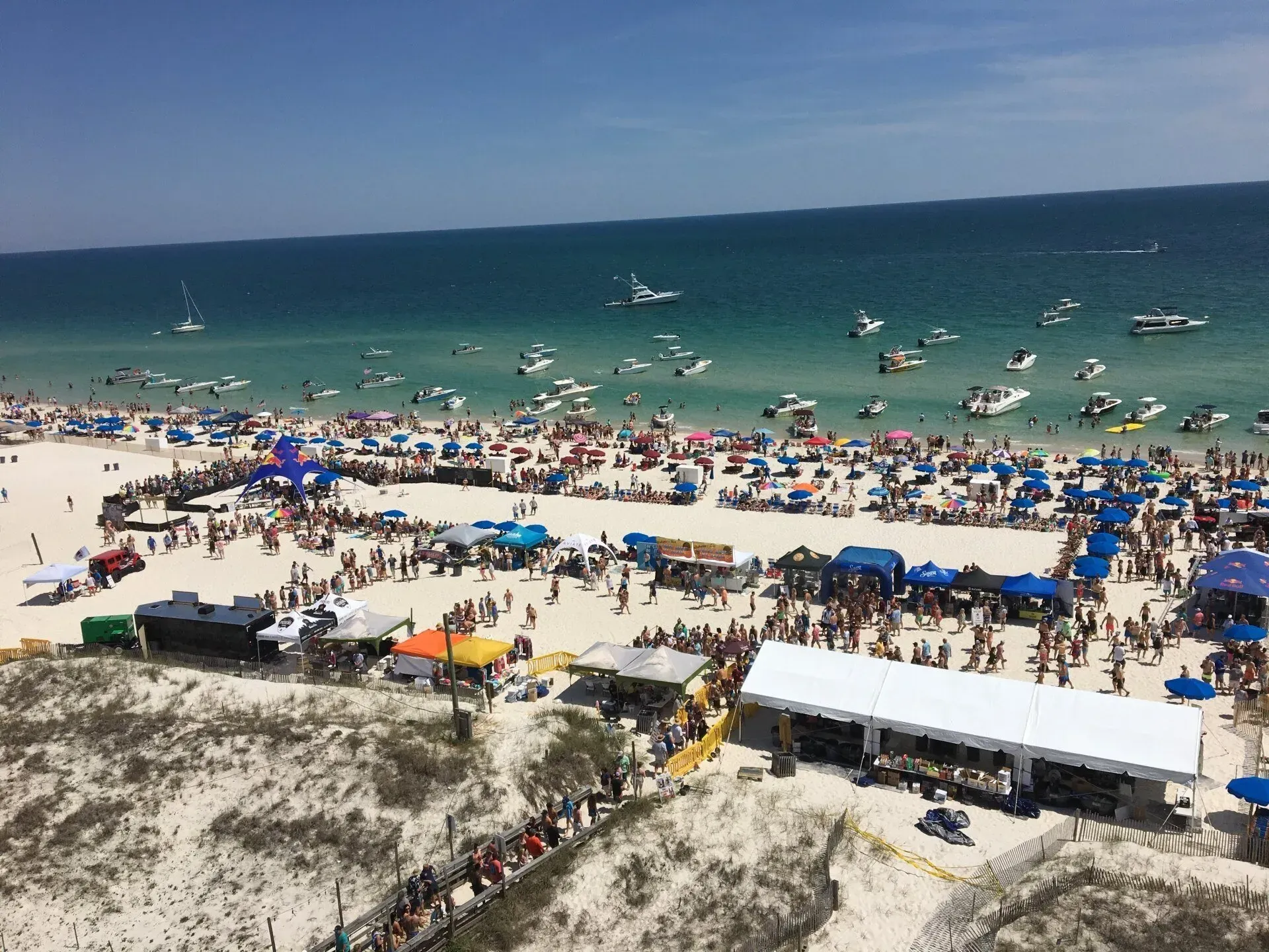
Orange Beach, Ala. – (OBA) – The 2025 Interstate Mullet Toss at the Flora-Bama is only a week away, and it’s shaping up to be the biggest. Whether you're a seasoned tosser or a first-time visitor, this legendary beach party promises a weekend full of sun, sand, music, and, of course, flying fish. But before you pack your bags and head down to the Flora-Bama line, there are a few important things to know to help you make the most of your Mullet Toss weekend.
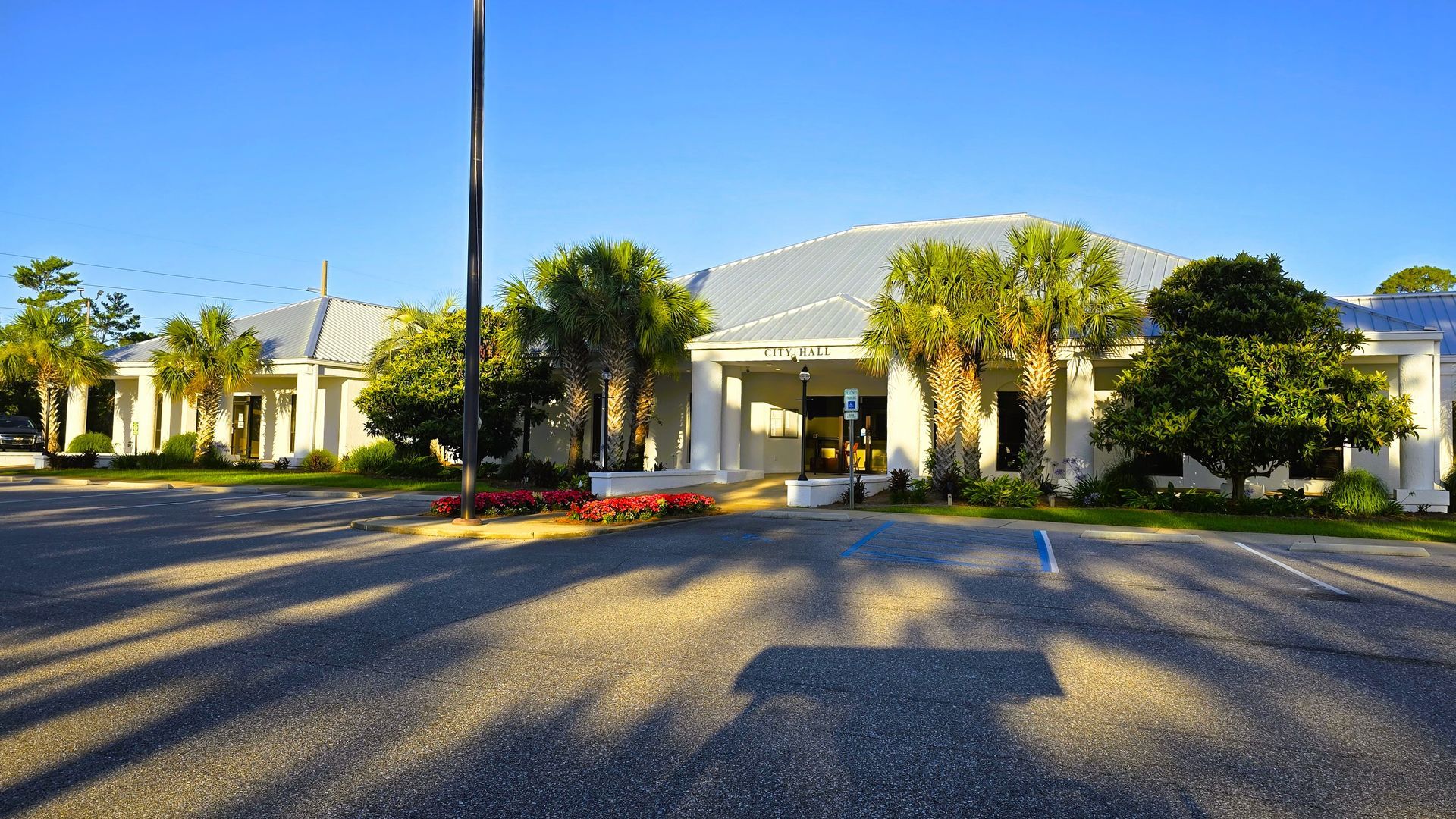
Orange Beach, Ala. – (OBA) – In a move to preserve its natural beauty and maintain public safety, the City of Orange Beach has adopted new regulations restricting business activities on beaches, shorelines, and waterways. The ordinance, passed on April 15, 2025, amends the city’s Business License Code to prohibit most forms of commercial activity in these sensitive areas.
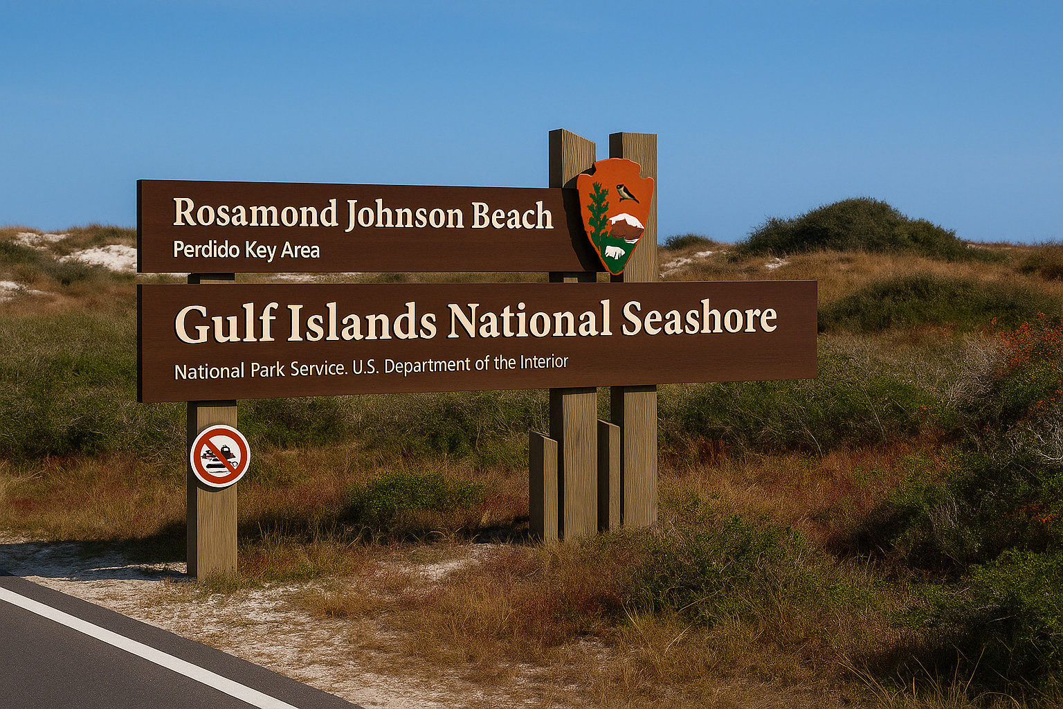
Perdido Key, Fla. – (OBA) – The United States National Park System is a vast collection of protected lands and seas. While the National Park Service (NPS) oversees a network of over 433 distinct parks, including battlefields, monuments, seashores, and preserves. There are 63 National Parks in the United States. The first National Park in the United States — and the world — was Yellowstone National Park, established on March 1, 1872.

Foley, Ala. – (OBA) – Foley’s recognition of the 250th anniversary of the American Revolution will begin with a commemoration of the Battle of Lexington.
Orange Beach, Ala. – (OBA) – Orange Beach is preparing to celebrate those who make a difference in their communities with a special event dedicated to local heroes. The evening will highlight individuals who have demonstrated extraordinary service and compassion along the Gulf Coast.
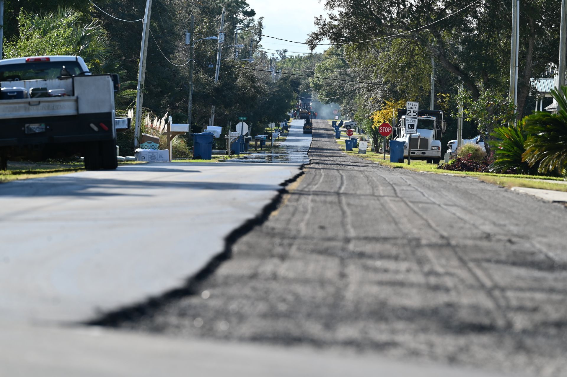
Orange Beach, Ala. – (OBA) – Twelve city streets in the Bear Point neighborhood are scheduled for resurfacing starting in late April, weather permitting, as part of Orange Beach’s 2025 Roadway Resurfacing project.
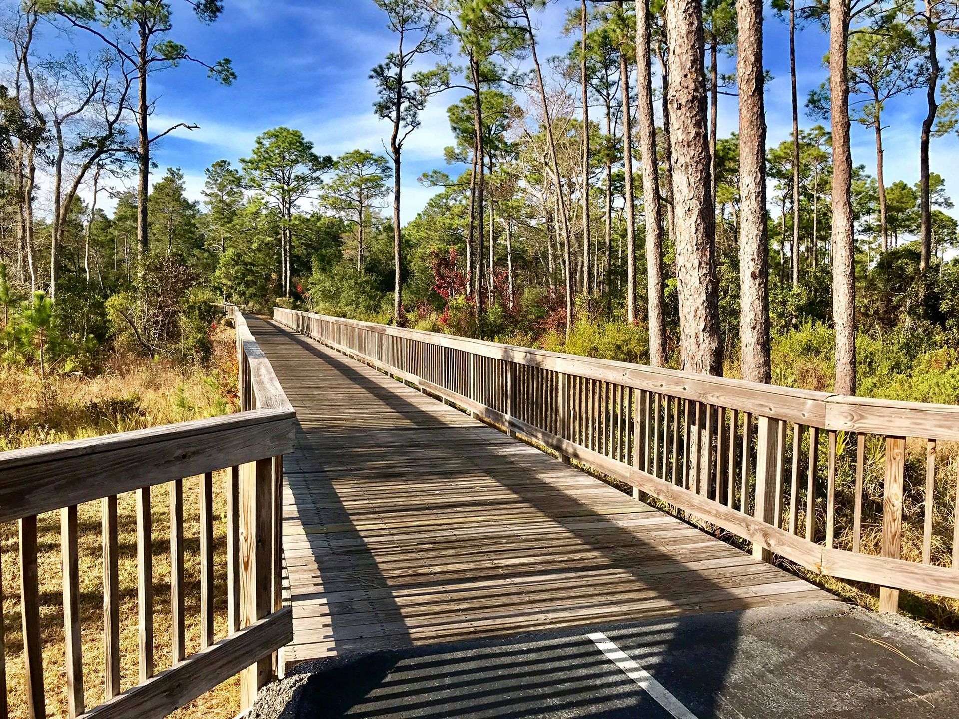
Orange Beach, Ala. – (OBA) – The Hugh S. Branyon Backcountry Trail in Gulf State Park has once again been honored as the best recreational trail in the United States, securing the top spot in USA Today's 10Best Readers' Choice Awards for 2024. This marks the third consecutive year the trail has received this national recognition, underscoring its status as a premier destination for outdoor enthusiasts.
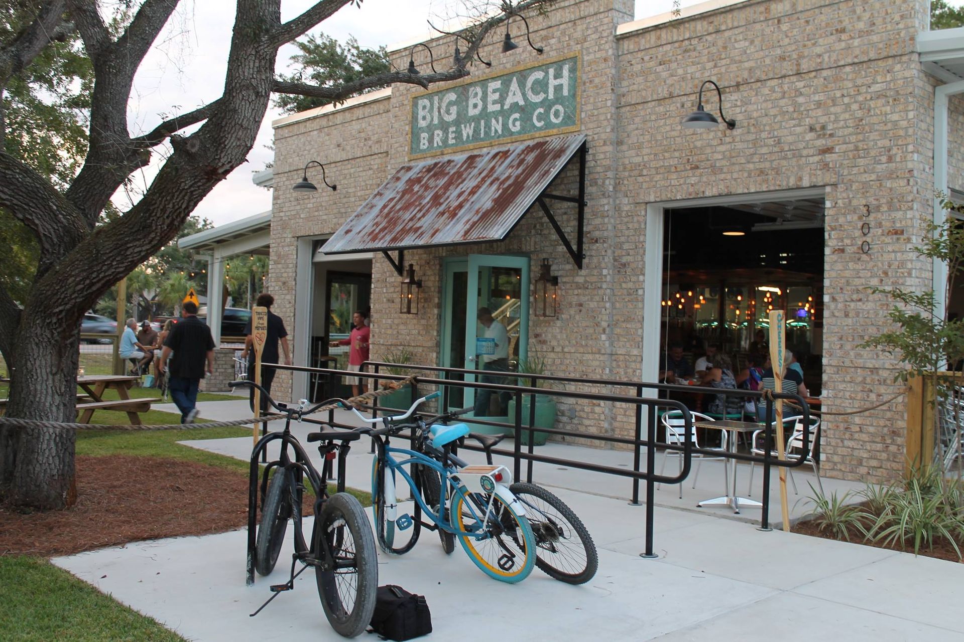
Gulf Shores, Ala. – (OBA) – Big Beach Brewing in Gulf Shores has new owners. After nearly nine years of family operation, the local favorite changed hands on Monday, April 14.