
Severe Storm Advisory for the Orange Beach Area
Strong Storm Warnings Issued for Alabama/Florida Gulf Coast
Orange Beach, Ala. – (OBA) – Residents along the northern Gulf Coast should brace for a series of severe weather conditions beginning tomorrow, with the most intense impacts anticipated during the overnight hours of Monday, into Tuesday morning.
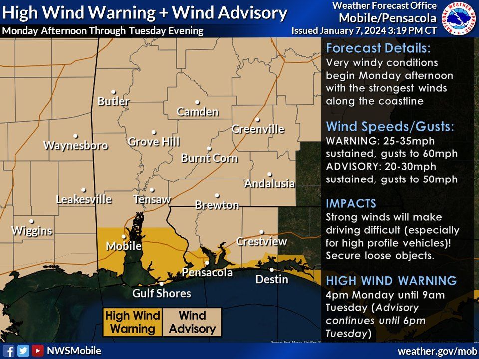
A combination of severe storms, including the potential for strong tornadoes and damaging winds, is expected to develop late Monday into Tuesday morning. Coastal areas are forecast to have windy conditions, with gusts potentially reaching 60 mph, necessitating precautions for outdoor items and decorations.
Below are the details from the National Weather Service-Mobile.

From the National Weather Service - Mobile: Where to begin? The beginning of this week is shaping up to be VERY IMPACTFUL with the worst of the impacts occurring in the overnight hours. That means you need to start considering how you will prepare SOON. Let's break down what will happen and potential impacts...
SEVERE STORMS - We are still increasingly concerned about the potential for damaging wind (70+ mph) & tornadoes (some could be strong EF2+) Monday night into Tuesday morning. The timeframe with the greatest threat for tornadoes is from 3-9am Tuesday. Conditions will go downhill quickly during that timeframe where we expect to go from a few storms to widespread severe storms.
Note that there will be a wave of rain showers that pushes inland from the Gulf of Mexico on Monday afternoon, but we are not concerned about that first wave.
Windy conditions are expected area-wide starting Monday afternoon with VERY WINDY conditions along the coast (gusts to 60mph). You need to secure or relocate items outside that can blow around. Don’t forget MARDI GRAS DECORATIONS, trash cans, grills, potted plants, and trampolines.
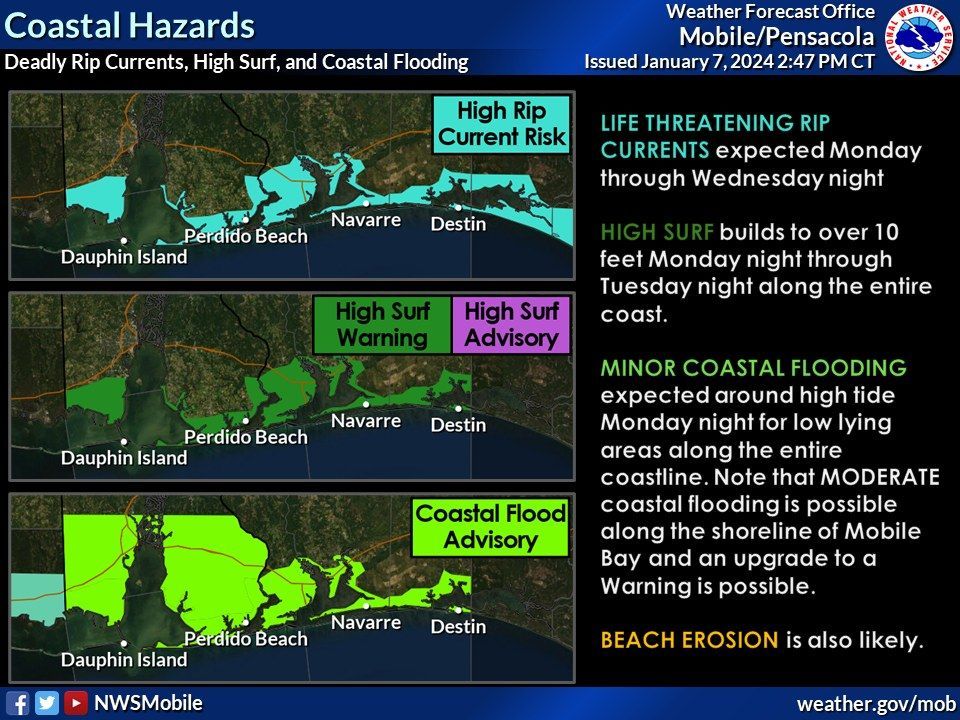
Given the strong winds, there will be a LOT of coastal impacts. LIFE-THREATENING RIP CURRENTS are expected Monday through Wednesday night. HIGH SURF builds to 10+ feet Monday night through Tuesday night. COASTAL FLOODING is expected Monday night for the entire coast. The Coastal Flood Advisory may need to be upgraded to a Warning (especially along the shoreline of Mobile Bay) if guidance continues to trend upward with inundation values. Beach erosion is likely.
A *rare* STORM WARNING is in effect for all Gulf waters AND the bays, sounds, and waterways beginning Monday afternoon for sustained winds of 30-40 knots and gusts to 55 knots. Note: this is only the 2nd Storm Warning issued by us since 1994 for the Gulf waters.
Nighttime Storm Safety Reminders:
- Have multiple ways to receive warnings, including one that WAKE YOU UP,
- Charge your cellphone before you go to bed,
- Ensure the volume on your cellphone is turned up,
- Your cellphone should NOT be set to silent or "do not disturb".
Share this article w/ Friends...