Nighttime Storms Pose Threat to Gulf Coast Region
Intense Squall Line Could Bring Damaging Winds and Tornadoes, Especially After Midnight
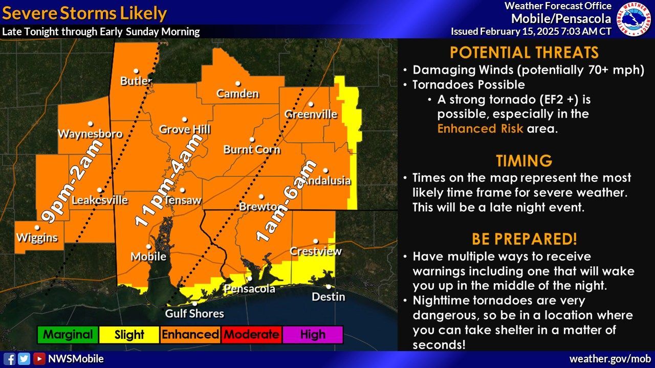
Orange Beach, Ala. – (OBA) – The National Weather Service (NWS) in Mobile, Alabama has issued an Enhanced Risk warning for severe weather across most of the Gulf Coast region late tonight into early Sunday morning. An intense squall line is expected to move through the area, bringing the potential for damaging winds exceeding 70 mph and the possibility of embedded tornadoes. Some storms may develop ahead of the main line, carrying a risk of tornadoes, including the potential for strong EF2+ tornadoes. The severe weather threat is anticipated between 9 p.m. and 6 a.m.
Residents are urged to have multiple ways to receive warnings, especially those that can alert them during the night. Nighttime tornadoes are particularly dangerous, so it's crucial to be in a location where shelter can be taken within seconds.
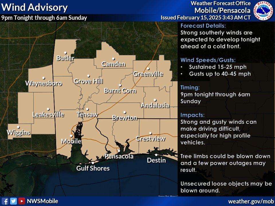
In addition to thunderstorms, the region will experience windy conditions tonight, with frequent gusts between 40 and 45mph starting around 9 p.m. and continuing overnight. These strong winds will create hazardous marine conditions, leading to the issuance of a Gale Warning. The Gale Warning will be in effect from 9 PM this evening to 6 AM CST Sunday. The Small Craft Advisory will be in effect from 6 AM Sunday to 9 AM CST Monday.
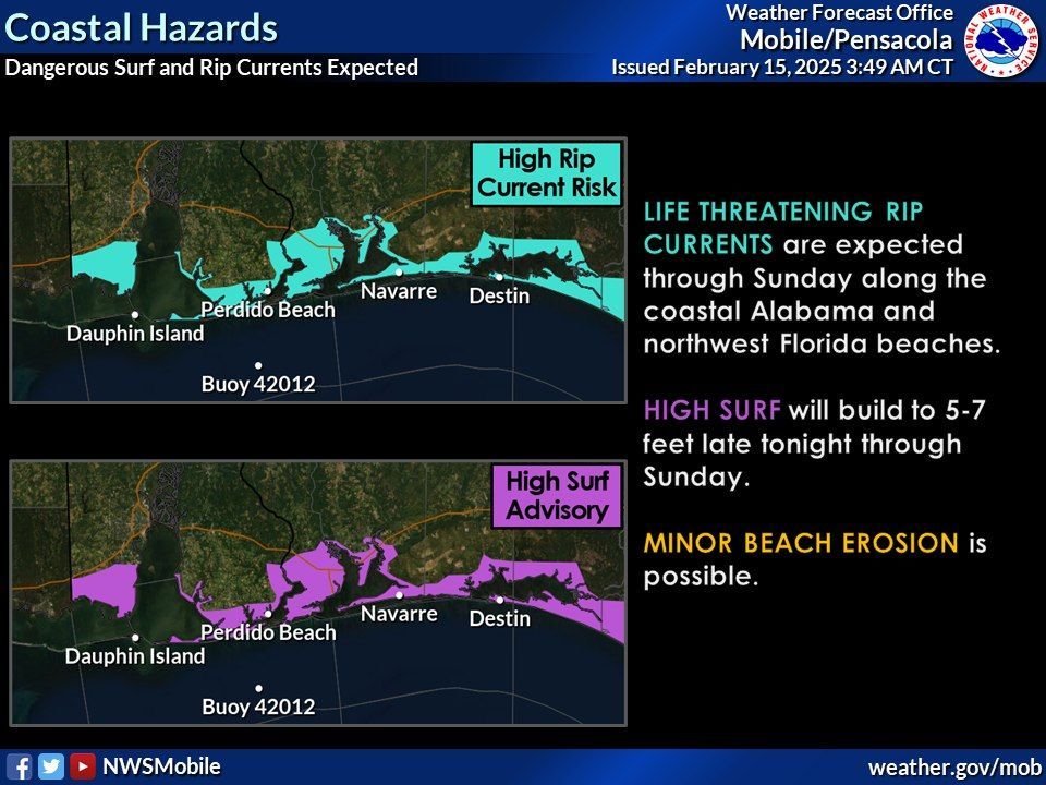
The high winds are also expected to result in elevated surf and dangerous swimming conditions, with a high risk of rip currents persisting through Sunday.
Residents in the immediate Gulf Coast are in the slight risk area, while areas from around Foley northward are under a moderate risk. It's essential for everyone in the affected regions to stay informed and prepared for severe weather conditions.
For the latest updates and more detailed information, visit the National Weather Service's official
website.
Share this article w/ Friends...